If you wanted to build your world right from the very start, from the earliest point and evolve it forward in a realistic manner, it is good to start with tectonic plates. These will help shape your continents and geographical features. It can also be fun to start building your world without knowing exactly what it will end up like.
You might prefer to simply draw your map by hand, use a random or semi random generator or not use a map at all, but if you want to start with tectonic plates then read on.
(An alternate use for this guide is draw your continent outlines, and then use the techniques described to produce mountain ranges, island chains and other features, or if you already have part of the map in mind, draw the involved plates and use that to determine the rest of your map. For example if you had an island with a mountain range, you might draw that as two plates converging which could lead to divergence on the other side of the plate occurring.)
Step 1: Creating Your Plates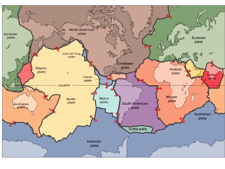
Looking at the above diagram, you can see that your plates will roughly determine the shapes of your continents. Begin by dividing the map into a number of different sections with different irregular shapes and sizes, perhaps between 8 and 10. Use the above diagram for inspiration of how they might look.
Then for the each plate, decide the direction it is travelling. This will result in one of three options for each contact point between plates. The options are plates moving towards each other, moving apart or moving side by side.
Step 1b: Continental or Oceanic
Label each of your plates as either continental (land) or oceanic (sea). This will result in the basic shape of your continents. Your borders wont need to follow the plate boundaries, but it does indicate that this area will be mainly land and this area will be mainly sea. I wouldn’t recommend having more than a third the number of oceanic plates as continental, though this can depend on how many major sea areas you want.
Convergence: Plates Moving Towards Each Other
This will cause earthquakes and if underwater, tsunamis. The result depends on the type of plates.
Both Continental: Both plates are pushing up into each other causing big mountain ranges, think of the Himalayas, and earthquakes. If they are in the sea, it can cause island arcs.
One Oceanic and One Continental: The oceanic plate is being forced under the continental one resulting in mountains and volcanoes. If they are underwater it will cause deep underwater ravines.
Both Oceanic: This causes deep underwater ravines, island chains as well as volcanic islands.
Divergence: Plates Moving Apart
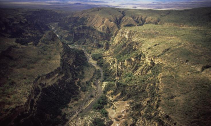
On land this gradually causes mountains, but causes earthquakes, volcanoes, canyons and rift valleys such as the one below.
Transform: Both Plates Are Sliding Past Each Other
This causes lots of earthquakes, but rarely tsunamis. The impact on terrain is minimal, but remember the earthquakes as they will have an impact on the cultures developing there.

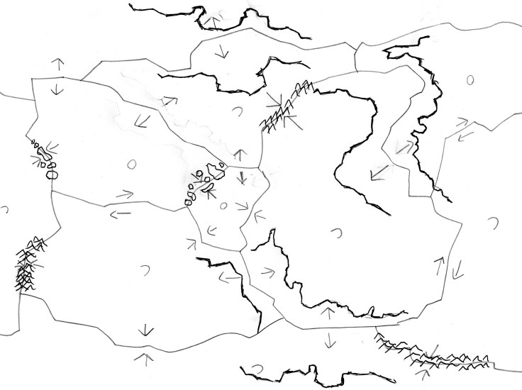
So at this point, we might have something like this. A number of plates with some movement. Don’t worry about whether your movements are exact, they are just to guide you.
Step 2: Drawing Coasts
When drawing your landmasses, it is important to remember this is a creative exercise, so if you want to draw something a particular way do so. This process just provides you with guidance to do it in a realistic way.
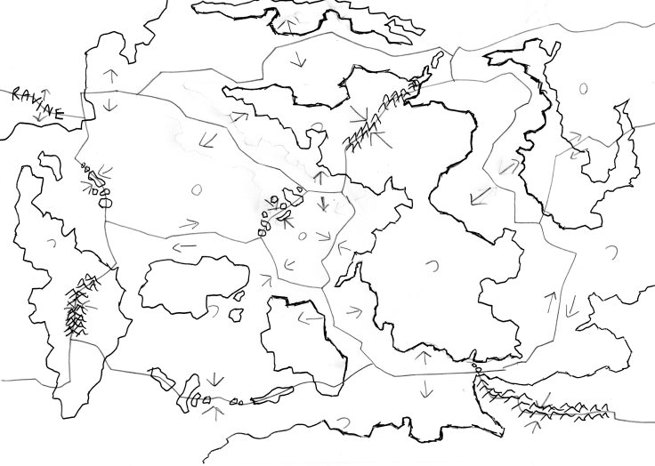
Start with continental divergence edges. Once these plates would have fitted together so draw coasts that look they could have once slotted in to each other. Think South America and Africa. You might also want to draw a ravine/rift valley here if you want t.
After drawing a couple of coastlines, I decided to turn my map upside down. I then added some mountains in the appropriate spots and a few island chains.
Looking at the coasts on the map, see if you can picture the outlines of any continents, taking into account which plates are continental and which are oceanic. Then look at your convergence edges. If these fall in your idea of where the continent is, draw mountains, if not, consider drawing an arc shaped island chain, think Indonesia. Some of these islands might be volcanic, perhaps make a note of which you choose.
Where a mountain range meets the sea. The mountain ranges don’t stop straight away, they decrease in elevation and eventually flatten out, with the peaks becoming a peninsula and then perhaps an island chain.
From there, draw the rest of your continents how you like using the coasts produced from your divergence coasts, the locations of mountain ranges, island chains and sea areas to guide you. Let the coast line flow out of you and don’t be tempted to make straight lines. Coasts are wavy and have peninsulas and bays and such features.
After filling out the rest of the map, I ended up with this. Notice how, despite the top right plate being labeled as oceanic, I ended up with a land on this area. Feel free to add and take away where you see fit. Don’t feel bound by your earlier decisions.
Step 3: Go Back and Edit
This is your world to make how you see fit, so if there’s something you don’t particularly like, or would rather see, then by all means add that to your map, even if its something as simple as a couple of island in the middle of your oceanic plate.
Step 4: Tidy Up
I threw it into Wonderdraft and drew it up.

